TURNING YOUR FACILITY INTO A DIGITAL TWIN
From Physical Space to Digital Insight.
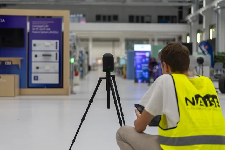
At NAiSE, we provide on-site 3D scanning and mapping to create detailed digital representations of your facility. These scans are designed primarily for visualization purposes – helping you and your team better understand spatial dynamics without limiting how the system itself functions. This approach offers unmatched flexibility in how you plan and optimize your intralogistics.
How Customers Use It
Many of our customers rely on 3D scans to visualize their facilities more clearly, making it easier to analyze layouts, identify potential bottlenecks, and plan future adjustments. The digital models serve as a powerful tool for collaboration and decision-making.
Maximum Flexibility
It’s important to note that the 3D environment does not define system functionality. All core features of NAiSE operate independently of the 3D map. That means you can choose whether or not to use 3D visualization, depending on your needs.
And if 3D scanning doesn’t make sense for your operations—for example, if your facility changes too drastically or too frequently—you still have full control. Customers can upload 2D maps independently, as often as needed, in any document format, with no limits.
Your Advantage with NAiSE
Whether through high-resolution 3D visualization or the simplicity of 2D maps, NAiSE ensures you always have the right level of insight into your facility. The result is complete flexibility: adapt your space digitally in the way that best supports your intralogistics strategy.